
ছবি:Polynesia.png
এই প্রাকদর্শনের আকার: ৬০০ × ৬০০ পিক্সেল। অন্যান্য আকারসমূহ: ২৪০ × ২৪০ পিক্সেল | ৪৮০ × ৪৮০ পিক্সেল | ৭৬৮ × ৭৬৮ পিক্সেল | ১,০২৪ × ১,০২৪ পিক্সেল | ২,০০০ × ২,০০০ পিক্সেল।
আয়ৌপা ফাইলগ (২,০০০ × ২,০০০ পিক্সেল, ফাইলর সাইজহান: ৬০৫ কিলোবাইট, এমআইএমই-র অংতা: image/png)

|
This locator map image could be re-created using vector graphics as an SVG file. This has several advantages; see Commons:Media for cleanup for more information. If an SVG form of this image is available, please upload it and afterwards replace this template with
{{vector version available|new image name}}.
It is recommended to name the SVG file “Polynesia.svg”—then the template Vector version available (or Vva) does not need the new image name parameter. |
| বারে |
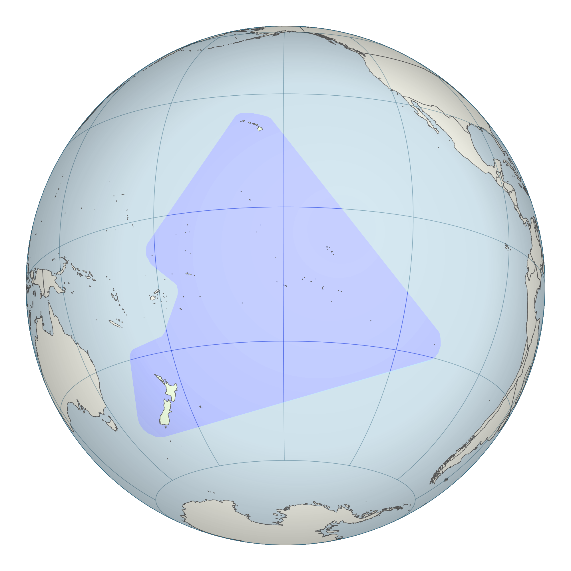
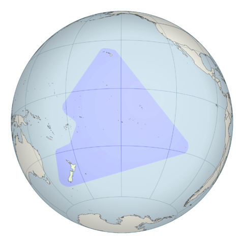
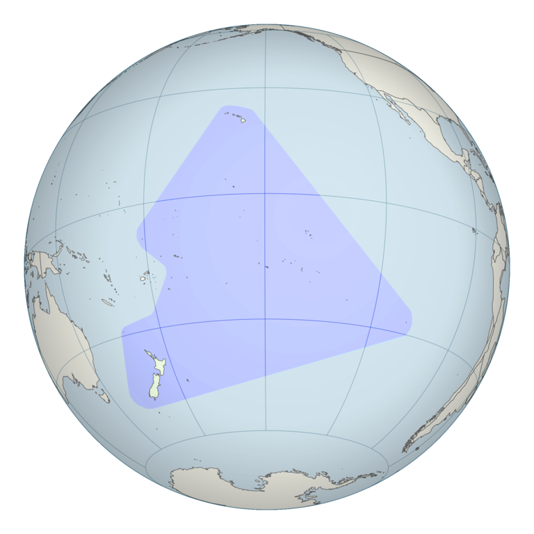
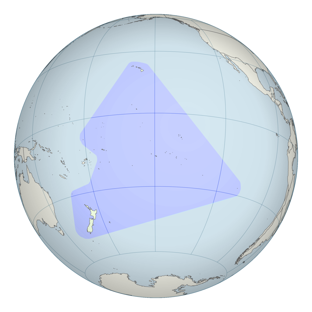
English: Polynesian triangle stretching from New Zealand in the south to Easter Island in the east and Hawaii in the north. This is a modification of File:French Polynesia (orthographic projection, yellowblue).svg. |
||
| তারিখ | ( | ||
| উৎস | See File:French Polynesia (orthographic projection, yellowblue).svg; Map information based on Vaka Moana: Voyages of the Ancestors - the discovery and settlement of the Pacific, ed K.R. Howe, 2008, p57. | ||
| ইকরেকুরা | User:Kahuroa | ||
| অনুমতি (এ ফাইলের পুনঃব্যবহার) |
|
.svg)
| Annotations | This image is annotated: View the annotations at Commons |
ফাইলর ইতিহাস
দিন/সময়-র গজে যাতিলে ঔ খেন্তাম পেয়া হঙিসে ফাইলগ চ পারতেই।
| দিন/সময় | হুরকাকরে ফটকগি | চাঙহান | আতাকুরা | মতহান | |
|---|---|---|---|---|---|
| এপাগা | ২০:৪৩, ২৬ অক্টোবর ২০১০ | | ২,০০০ × ২,০০০ (৬০৫ কিলোবাইট) | Kahuroa | include Norfolk Island |
| ০৫:১৫, ২৬ অক্টোবর ২০১০ |  | ২,০০০ × ২,০০০ (৬১৫ কিলোবাইট) | Kahuroa | more colour for background | |
| ০৪:১৫, ২৬ অক্টোবর ২০১০ |  | ২,০০০ × ২,০০০ (৫৭৩ কিলোবাইট) | Kahuroa | new version - corrects gross geographic errors of previous one. | |
| ০৮:৪৩, ২৩ আগস্ট ২০০৭ |  | ৩৮৬ × ২৯৮ (৪ কিলোবাইট) | Quizimodo~commonswiki | updated; removing NZ (c.f. Australasia) | |
| ১৩:৩২, ৩ এপ্রিল ২০০৭ |  | ৩৮৬ × ২৯৮ (৩৬ কিলোবাইট) | TadejM | {{Information |Description=This is a simple modification of en:Image:BlankMap-World.png. |Source=Originally from [http://en.wikipedia.org en.wikipedia]; description page is/was [http://en.wikipedia.org/w/index.php?title=Image%3APolynesia.png here]. | |
জুরিসিতা
এরে ফাইলর লগে 58 পাতাহানির মিলাপ আসে:
- অস্ট্রেলিয়া
- অস্ট্রেলিয়ার চিনত্হান
- অস্ট্রেলিয়ার ফিরালহান
- আমেরিকান সামোয়া
- ওশেনিয়ার চিনত্হান
- কালেডোনিয়া
- কিরিবাতি
- কিরিবাতির চিনত্হান
- কিরিবাতির ফিরালহান
- কোক দ্বীপমালা
- কোকোস (কিলিং) দ্বীপমালার ফিরালহান
- ক্রিসমাস দ্বীপমালার ফিরালহান
- গুৱাম
- টঙ্গা
- টঙ্গার চিনত্হান
- টঙ্গার ফিরালহান
- টুভালু
- টুভালুর চিনত্হান
- টুভালুর ফিরালহান
- টোকেলু
- নরফোক দ্বীপমালা
- নর্দান মেরিন দ্বীপমালা
- নাউরু
- নাউরুর চিনত্হান
- নাউরুর ফিরালহান
- নিউজিল্যান্ড
- নিউজিল্যান্ডর চিনত্হান
- নিউজিল্যান্ডর ফিরালহান
- নুউ
- পাপুয়া নিউগিনি
- পাপুয়া নিউগিনির চিনত্হান
- পাপুয়া নিউগিনির ফিরালহান
- পালাউ
- পালাউর চিনত্হান
- পালাউর ফিরালহান
- পিটকাইর্ন দ্বীপমালা
- ফিজি
- ফিজির চিনত্হান
- ফিজির ফিরালহান
- ফ্যাঞ্চ পলিনেসিয়া
- ভানুয়াতু
- ভানুয়াতুর চিনত্হান
- ভানুয়াতুর ফিরালহান
- মাইক্রোনেশিয়া তিলপারাষ্ট্র
- মাইক্রোনেশিয়া তিলপারাষ্ট্রর চিনত্হান
- মাইক্রোনেশিয়া তিলপারাষ্ট্রর ফিরালহান
- মার্শাল দ্বীপমালা
- মার্শাল দ্বীপমালার চিনত্হান
- মার্শাল দ্বীপমালার ফিরালহান
- মুঙ তিমুর
- সলোমন দ্বীপমালা
- সলোমন দ্বীপমালার চিনত্হান
- সলোমন দ্বীপমালার ফিরালহান
- সামোয়া
- সামোয়ার চিনত্হান
- সামোয়ার ফিরালহান
- ৱাল্লিস বারো ফুটুনা
- মডেল:ওশেনিয়ার বারে
ফাইলের বৈশ্বিক ব্যবহার
নিচের অন্যান্য উইকিগুলো এই ফাইলটি ব্যবহার করে:
- ar.wikipedia.org-র ব্যবহারহান
- ca.wikipedia.org-র ব্যবহারহান
- cs.wikipedia.org-র ব্যবহারহান
- cy.wikipedia.org-র ব্যবহারহান
- Awstralasia
- Oceania
- Awstralia
- Seland Newydd
- Twfalw
- Ffiji
- Ciribati
- Ynysoedd Cook
- Nodyn:Gwledydd a thiriogaethau Oceania
- Polynesia
- Tonga
- Ynysoedd Solomon
- Taleithiau Ffederal Micronesia
- Papua Gini Newydd
- Ynysoedd Marshall
- Nawrw
- Fanwatw
- Samoa
- Palaw
- Ynys Norfolk
- Caledonia Newydd
- Polynesia Ffrengig
- Melanesia
- Niue
- Ynysoedd Pitcairn
- Ynys y Nadolig
- Wallis a Futuna
- Tocelaw
- Gwam
- Samoa America
- Ynysoedd Cocos
- Ynysoedd Gogledd Mariana
- Ynysoedd Gilbert
- Ynys Clipperton
- da.wikipedia.org-র ব্যবহারহান
এই ফাইলের অন্যান্য বৈশ্বিক ব্যবহার দেখুন।