
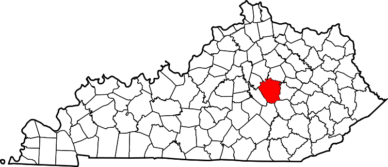
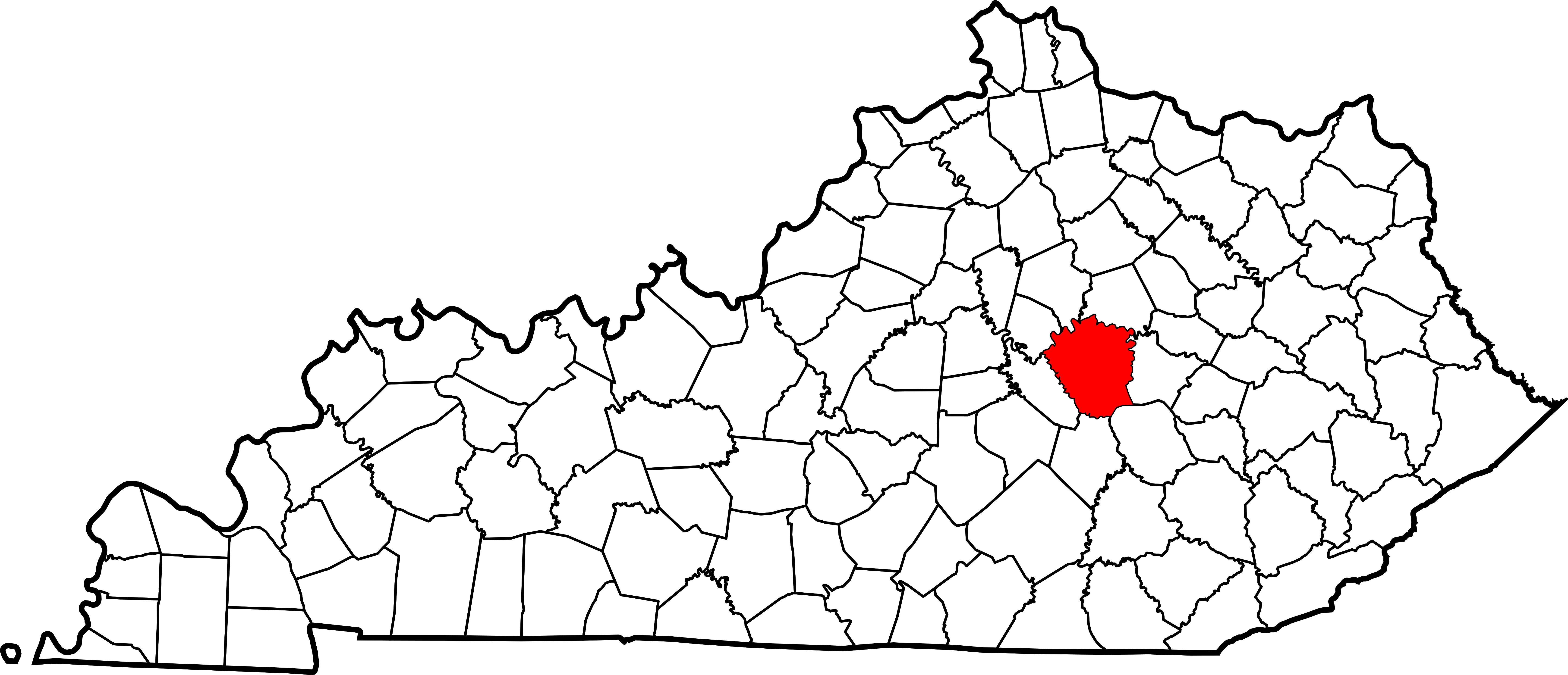
ছবি:Map of Kentucky highlighting Madison County.svg

এই SVG ফাইলের জন্য এই PNG প্রাকদর্শনের আকার: ৮০০ × ৩৪৫ পিক্সেল। অন্যান্য আকারসমূহ: ৩২০ × ১৩৮ পিক্সেল | ৬৪০ × ২৭৬ পিক্সেল | ১,০২৪ × ৪৪১ পিক্সেল | ১,২৮০ × ৫৫১ পিক্সেল | ২,৫৬০ × ১,১০৩ পিক্সেল | ৬,৭৭০ × ২,৯১৬ পিক্সেল।
আয়ৌপা ফাইলগ (SVG ফাইল, সাধারনত ৬,৭৭০ × ২,৯১৬ পিক্সেল, ফাইলর সাইজহান: ১২৭ কিলোবাইট)
সারাংশ
| বারে |
English: This is a locator map showing Madison County in Kentucky. For more information, see Commons:United States county locator maps. |
| তারিখ | |
| উৎস |
নিজের কাজ: English: The maps use data from nationalatlas.gov, specifically countyp020.tar.gz on the Raw Data Download page. The maps also use state outline data from statesp020.tar.gz. The Florida maps use hydrogm020.tar.gz to display Lake Okeechobee. |
| ইকরেকুরা | David Benbennick |
লাইসেন্সহান
| আমি, এই কাজের স্বত্বাধিকারী, এতদ্দ্বারা আমি এই কাজকে পাবলিক ডোমেইন লাইসেন্সের আওতায় প্রকাশ করলাম। এটি বিশ্বব্যাপী প্রযোজ্য হবে। কিছু দেশে এটি আইনত সিদ্ধ নাও হতে পারে, যদি তাই হয়: আমি যে-কাউকে এই কাজটি যেকোনো উদ্দেশ্যে, বিনাশর্তে ব্যবহারের অনুমতি প্রদান করছি, যদি না সেই শর্তগুলো আইনত প্রয়োজনীয় হয়। |
ফাইলর ইতিহাস
দিন/সময়-র গজে যাতিলে ঔ খেন্তাম পেয়া হঙিসে ফাইলগ চ পারতেই।
| দিন/সময় | হুরকাকরে ফটকগি | চাঙহান | আতাকুরা | মতহান | |
|---|---|---|---|---|---|
| এপাগা | ১২:২৩, ১২ ফেব্রুয়ারী ২০০৬ | | ৬,৭৭০ × ২,৯১৬ (১২৭ কিলোবাইট) | David Benbennick | {{subst:User:Dbenbenn/clm|county=Madison County|state=Kentucky}} |
জুরিসিতা
এরে ফাইলর লগে পাতার মিলাপ আসে:
ফাইলের বৈশ্বিক ব্যবহার
নিচের অন্যান্য উইকিগুলো এই ফাইলটি ব্যবহার করে:
- ar.wikipedia.org-র ব্যবহারহান
- bg.wikipedia.org-র ব্যবহারহান
- cdo.wikipedia.org-র ব্যবহারহান
- ceb.wikipedia.org-র ব্যবহারহান
- ce.wikipedia.org-র ব্যবহারহান
- cs.wikipedia.org-র ব্যবহারহান
- cy.wikipedia.org-র ব্যবহারহান
- de.wikipedia.org-র ব্যবহারহান
- en.wikipedia.org-র ব্যবহারহান
- Madison County, Kentucky
- Berea, Kentucky
- Richmond, Kentucky
- Boonesborough, Kentucky
- List of counties in Kentucky
- Silver Creek (Kentucky)
- Waco, Kentucky
- Wilgreen Lake
- Template:Madison County, Kentucky
- Valley View, Kentucky
- Bybee, Kentucky
- Bighill, Kentucky
- Kirksville, Kentucky
- User:Nyttend/County templates/KY/2
- Round Hill, Kentucky
- National Register of Historic Places listings in Madison County, Kentucky
- College Hill, Kentucky
- Category:Populated places in Madison County, Kentucky
- Buggytown, Kentucky
- Moberly, Kentucky
- Baldwin, Kentucky
- Ruthton, Kentucky
- Speedwell, Kentucky
- Template:MadisonCountyKY-geo-stub
- Dreaming Creek (Kentucky)
- Million, Kentucky
- Bobtown, Kentucky
- Kingston, Kentucky
- Redhouse, Kentucky
- Newby, Kentucky
- Union City, Kentucky
- es.wikipedia.org-র ব্যবহারহান
এই ফাইলের অন্যান্য বৈশ্বিক ব্যবহার দেখুন।